


Mallorca Topo Maps
Mô tả của Mallorca Topo Maps
+++ New GPS Mapping App +++
Dễ dàng sử dụng ngoài trời / offline GPS ứng dụng hướng tiếp cận với các bản đồ địa hình tốt nhất và hình ảnh trên không cho Mallorca.
++ Đối với các tính năng PRO sử dụng ngoại tuyến cần thiết! ++
Bật điện thoại Andoid của bạn / máy tính bảng thành một GPS ngoài trời để đi đến các hẻo lánh KHÔNG BÀO HIỂM. Ứng dụng này cung cấp cho bạn tùy chọn bản đồ tương tự như bạn có thể biết từ Garmin hay Magellan GPS cầm tay.
Bao gồm các lớp bản đồ miễn phí:
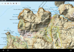
• Mallorca Topo Map: Bản Một Topográfico Nacional 1: 50.000 và 1: 25.000 (IGN MTN25 & MTN50)
• Mallorca Bản đồ cơ sở: Cơ sở IGN Topográfica Nacional 1: 25.000 (BTN25 & BCN25)
• Mallorca Hình ảnh: hình ảnh trên không có độ phân giải cao. Kế hoạch Nacional de Ortofotografía Aérea (PNOA)
• Đất đai Đăng ký Bản đồ: Cartografía Catastral
• OpenStreetMap: Những bản đồ cộng đồng đóng góp là một bổ sung rất hữu ích cho các lớp bản đồ khác. Có nhiều tính năng độc đáo.
• OpenCycleMaps: Những bản đồ này là lý tưởng cho kế hoạch chuyến đi xe đạp
• ESRI địa hình
• ESRI Aerial hình ảnh
• ESRI đường Bản đồ
• Google Lộ (truy cập trực tuyến chỉ)
• Google Hình ảnh vệ tinh (truy cập trực tuyến chỉ)
• Google Map Terrain (truy cập trực tuyến chỉ)
• Bing Lộ (truy cập trực tuyến chỉ)
• Bing Hình ảnh vệ tinh (truy cập trực tuyến chỉ)
• Tại Đêm Trái đất
• overlay Hillshading
Các tính năng chính cho ngoài trời-chuyển hướng:
• Tạo và chỉnh sửa Waypoints
• GoTo-waypoint-Navigation
• Theo dõi ghi âm (với tốc độ, độ cao và độ chính xác hồ sơ)
• Tripmaster với các lĩnh vực để đo đường, tốc độ trung bình, chịu lực, độ cao, vv
• GPX / KML / KMZ xuất khẩu
• Tìm kiếm (placenames, POI, đường phố)
• datafields chỉnh trong bản đồ và Tripmaster (ví dụ tốc độ, khoảng cách, la bàn, ...)
• Chia sẻ Waypoints, bài nhạc hoặc Các tuyến (thông qua email, Whatsapp, Dropbox, Facebook, ..)
• Hiển thị tọa độ Lat / Lon, UTM hoặc MGRS / USNG (Lưới Quân sự / Quốc gia Mỹ Grid)
• bài hát Record & chia sẻ với các thống kê và cấu hình độ cao
• Bản đồ Rotate (Track Up & Bắc Up)
• Nhận Elevation bởi bấm dài trên bản đồ
• Theo dõi Replay
• và nhiều cái khác ...
tính năng có sẵn Pro: (Pro các tính năng có sẵn thông qua Trong App Purchase)
• Ngoại tuyến sử dụng - không có phủ sóng di động cần thiết
• Dễ dàng + nhanh Bulk-tải các ô bản đồ cho OFFLINE SỬ DỤNG (không phải cho bản đồ của Google và Bing)
• Tạo và chỉnh sửa đường
• Route-Navigation (Point-to-Point Navigation)
• GPX / KML / KMZ nhập
• không giới hạn Waypoints & Tracks
• Thêm Map khác Tile-Server
• Không quảng cáo
Ẩn Sử dụng:
Tất cả các gạch đồ xem được lưu giữ trong bộ nhớ cache. Để nhớ cache khu vực lớn, bạn cần phải mua các tính năng Pro.
Sử dụng ứng dụng này chuyển hướng cho các hoạt động ngoài trời như đi bộ đường dài, đi xe đạp, cắm trại, leo núi, cưỡi ngựa, trượt tuyết, chèo thuyền, săn bắn, du lịch 4WD offroad hoặc tìm kiếm và cứu hộ (SAR).
Thêm điểm tham chiếu tùy chỉnh trong kinh độ / vĩ độ, UTM hoặc định dạng MGRS / USNG với WGS84 chuẩn.
Import / Export / Chia sẻ GPS-Waypoints / Tracks / Các tuyến trong định dạng Google Earth KML / KMZ GPX hay.
Preload dữ liệu bản đồ miễn phí cho các khu vực không có dịch vụ di động (tính năng Pro!).
Nhận xét và yêu cầu tính năng mallorcamaps@atlogis.com
Có một cái nhìn tại các ứng dụng định vị ngoài trời khác của chúng tôi: https://play.google.com/store/search?q=atlogis
+++ Chúng tôi KHÔNG theo dõi các hoạt động của người dùng hoặc thu thập dữ liệu người sử dụng! +++
Mallorca Topo Maps - Phiên bản 7.7.2
(22-03-2025)Mallorca Topo Maps - Thông tin APK
Phiên bản APK: 7.7.2Gói: com.atlogis.mallorcaPhiên bản mới nhất của Mallorca Topo Maps
Phiên bản khác


Ứng dụng cùng danh mục


